


This page gathers various maps of the celestial sphere with primary focus on the constellation boundaries. Background information about constellation boundaries is available here.
Reproductions of the maps from Délimitation…
The maps in this series attempt to reproduce those included in Eugène Delporte's Délimitation Scientifique des Constellations [1] as faithfully as practical.
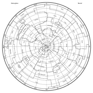
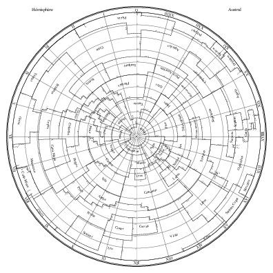
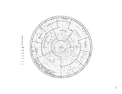
The two maps below reproduce the large maps of the northern and southern hemispheres that conclude the book. They specify the coordinates of the constellation boundaries. They use azimuthal equidistant projections on tangent planes at the poles.
| Northern Hemisphere | Southern Hemisphere |
|
|
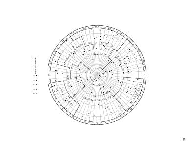
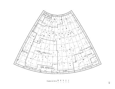
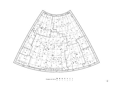
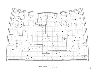
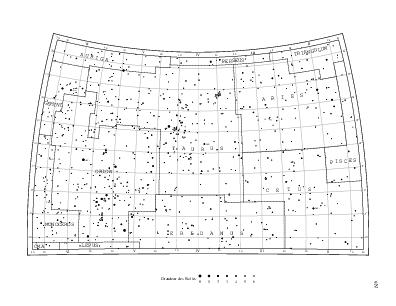
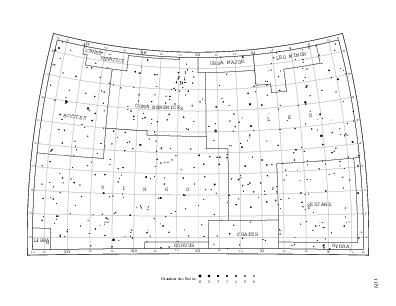
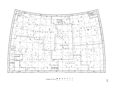
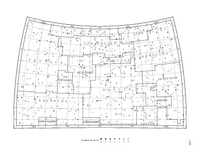
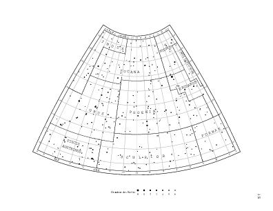
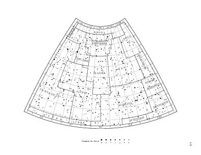
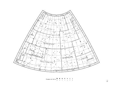
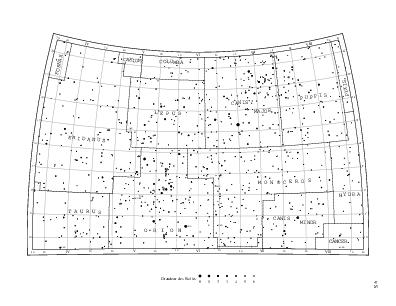
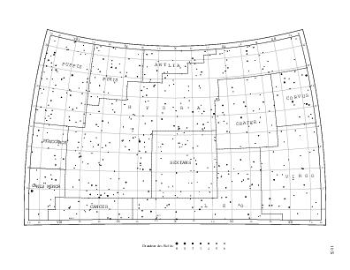
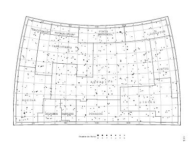
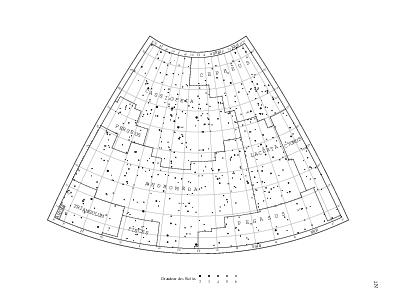
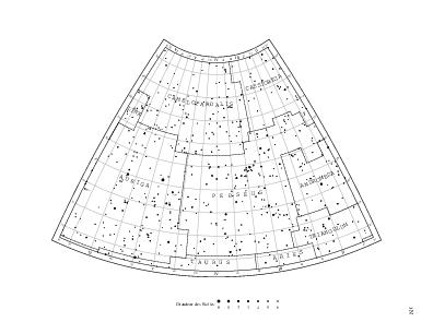
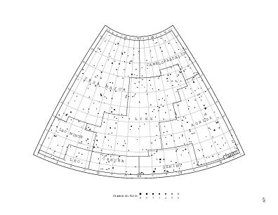
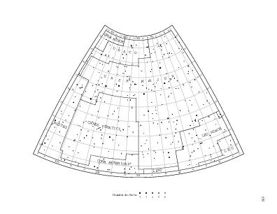
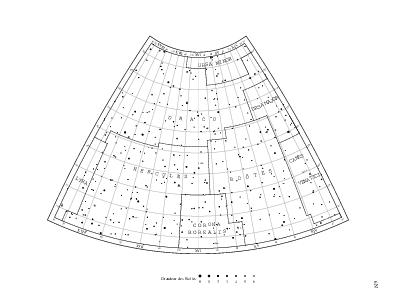
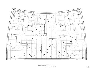
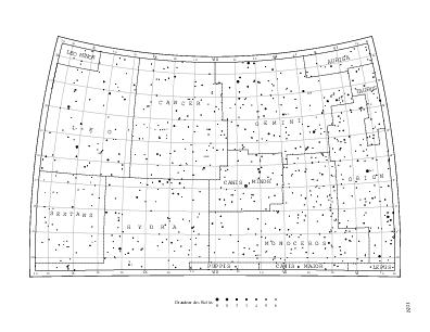
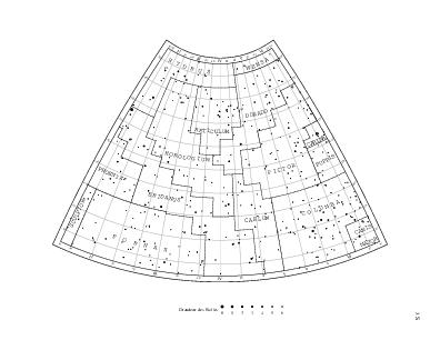
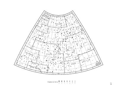
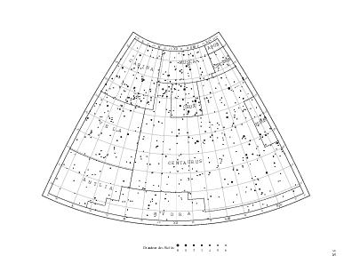
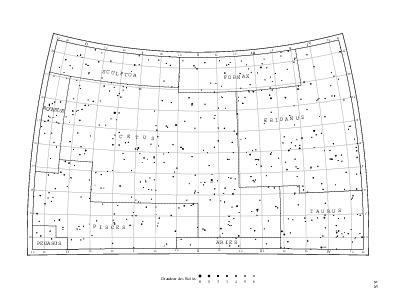
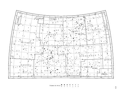
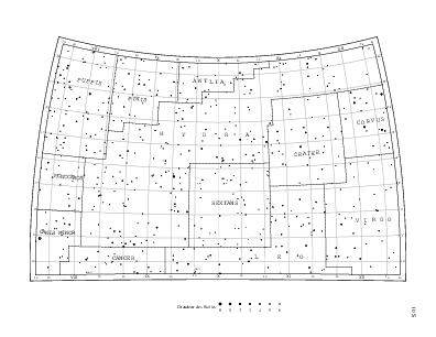
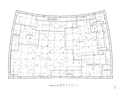
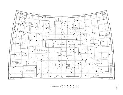
The twenty-six maps below reproduce the maps covering the celestial sphere, also included in Delporte's Atlas Céleste [2]. Felice Stoppa's site has images of the originals (see this example). I have used the stereographic projection onto the tangent plane to the celestial sphere at the center of the map from the opposite point. All the maps are drawn to the same scale, unlike the book's, where the ones centered at latitude ±50° and the ones centered at ±10° seem to use different scales (and even different scale factors along x and y). The equatorial coordinate system corresponds to the equinox of B1875.0.
The star set is the same as on these reference maps. It is based on the Bright Star Catalogue, with the positions taken from the Hipparcos catalog, adjusted to the B1875.0 epoch according to proper motion and precessed to the B1875.0 equinox.
Some variable stars are tagged with a var. label as in the originals. I have tagged the variable stars mentioned in the Atlas Céleste [2], but it turns out that they don't exactly match the ones tagged on Delporte's maps.
| 1N | 2N | 3N | 4N | 5N | 6N | 7N |
 |
 |
 |
 |
 |
 |
 |
| 8N | 9N | 10N | 11N | 12N | 13N | |
 |
 |
 |
 |
 |
 |
|
| 1S | 2S | 3S | 4S | 5S | 6S | 7S |
 |
 |
 |
 |
 |
 |
 |
| 8S | 9S | 10S | 11S | 12S | 13S | |
 |
 |
 |
 |
 |
 |
Variations on the maps from Atlas Céleste
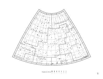
The maps below correspond one-to-one to the Atlas Céleste and Délimitation Scientifique des Constellations star maps, with an emphasis on the stars listed in the Atlas Céleste. The reference stars are grayed out and the Atlas Céleste stars are labeled and represented at their positions given in the Atlas Céleste by black circles, dashed for multiple stars, and underlined for variable stars. The variable stars are represented according to their maximum magnitude. The nebulae and clusters mentioned in the Atlas Céleste are represented by dotted circles.
After correction of a handful of typos in the Atlas Céleste affecting ι Cyg, σ Cyg, β Pyx, ι Vir, and ι Leo (labeled ν Leo in one instance), the positions are mostly indistinguishable from the reference stars'.
Stars are identified by a Bayer letter, Flamsteed number, or Argelander variable star identifier (single or double capital letter). The labels Cam 2H (for HR 1035) and Oph 27H (for HR 6493) refer to Flamsteed's version of Hevelius's catalog.
Nebulae and clusters are identified either by a Bayer letter (such as ω Cen), a Messier number (such as M31), a Herschel number (such as VIII.75) referring to William Herschel's catalog of deep sky objects, or in only one case (265 Δ) a number from James Dunlop's Catalog of deep sky objects.
| 1N | 2N | 3N | 4N | 5N | 6N | 7N |
 |
 |
 |
 |
 |
 |
 |
| 8N | 9N | 10N | 11N | 12N | 13N | |
 |
 |
 |
 |
 |
 |
|
| 1S | 2S | 3S | 4S | 5S | 6S | 7S |
 |
 |
 |
 |
 |
 |
 |
| 8S | 9S | 10S | 11S | 12S | 13S | |
 |
 |
 |
 |
 |
 |
Color maps
The maps below show the constellation boundaries from various points of view. I refer to then regularly for the relative positons of the constellations. They use B1875.0 coordinate systems so that the constellation boundaries align nicely with equatorial coordinate lines.
These six maps maps view the celestial sphere in the six directions of the cartesian axes of the equatorial coordinate system.
South view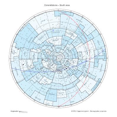
|
Capricorn view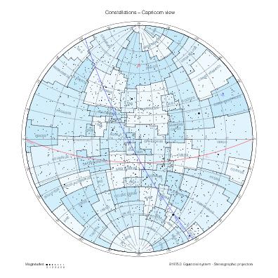
|
Libra view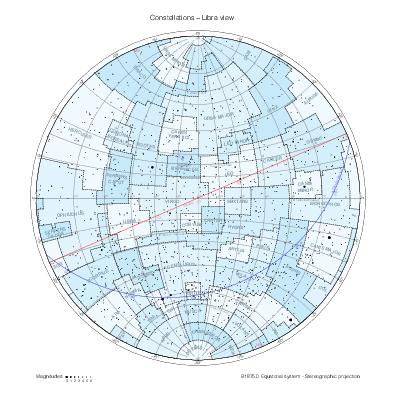
|
Cancer view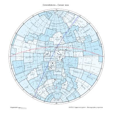
|
Aries view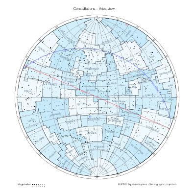
|
North view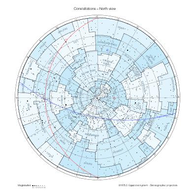
|
These three maps of the whole celestial sphere show the constellation boundaries with respect to the equatorial, ecliptic, and galactic coordinate systems.
Equatorial view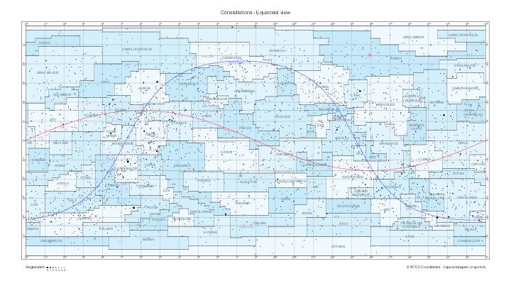
|
Ecliptic view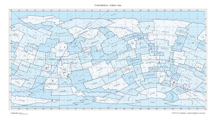
|
Galactic view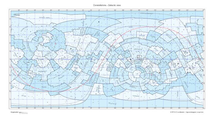
|
The last one overlays nicely with the maps in galactic coordinates at this NASA page.
References
[1] Eugène Delporte, Délimitation Scientifique des Constellations, Cambridge University Press, 1930.
[2] Eugène Delporte, Atlas Céleste, Cambridge University Press, 1930.